Long-Form

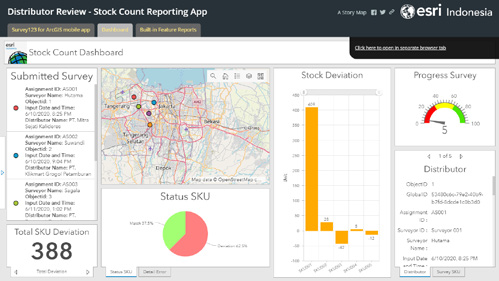
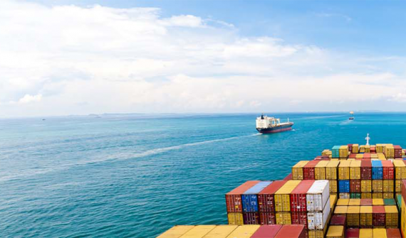
Charting the course towards a data-driven maritime industry

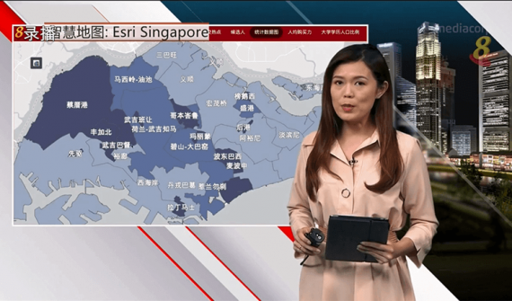
In an act of foresight, the Maritime and Port Authority of Singapore (MPA) officially announced GeoSpace-Sea in 2019, that sees a collaboration with 11 other government agencies and institutes of higher learning. It is an initiative designed to help answer current and new challenges in our sea-space – pandemic or otherwise.

GeoSpace-Sea is currently being populated with hydrographic data, coastal data, habitat data, and marine environment data such as coastline details.

But do not be mistaken:

GIS lessons learned during the COVID-19 pandemic

The introduction and enforcement of the Movement Control Order (MCO) was an important step to fight the outbreak, and with great success too. We also saw how Geographic Information Systems (GIS) technology was used extensively to support these efforts.

On the global scale, it showed how the virus was spreading across the world in real-time, and was also deployed for contact tracking and tracing. We quickly learned that the availability of data and information to all parties is crucial in battli

GE2020: Using a smart map to present insights and analysis

For the second general election in a row, all seats – of which there are 93 this time – in Singapore’s 31 constituencies are being contested. Campaigning is underway by the 191 candidates from 11 political parties and an independent candidate, all vying for support from the 2.65 million eligible voters.

To clearly and comprehensively present the vast statistics behind these figures to its viewers, Mediacorp’s Channel 8 and Channel U – Singapore’s leading channels for Chinese news and entertainment

Singapore is building a nation of young spatial thinkers

Two decades ago in Singapore, GIS was brought into secondary schools to help teach geography. But only a small number of teachers ended up actually adopting GIS to support their geography lessons. Since then, integration of GIS into school curriculum has been slow.

The Ministry of Education (MOE) in Singapore wanted to change that. So in early 2018, with help from Esri Singapore, the ministry’s Curriculum Planning and Development Division (CPDD) deployed MOE-EduGIS, a GIS platform that combines